Cockermouth voted the U.K.'s most Dog Friendly Town
We hope you’ve already heard that Cockermouth was awarded the title of the UK’s Most Dog Friendly town at the end of 2025. We’re thrilled with the accolade – this is a place that welcomes everyone, whether they have feet or paws!
With the Lake District and the Cumbrian coast on our doorstep for some of the best dog walks in the world, this is a fabulous place to live, work, visit and explore. So, we thought we’d give you a few good reasons to play out with your pooch in Cockermouth…
- There are countless dog walks in and around town with loads of green spaces perfect for off-lead playtimes – try Harris Park and Memorial Gardens as two easy options.
- Two rivers to swim in – access the Derwent from Memorial Gardens and the Cocker from the lower side of Harris Park.
- Two fabulous pet stores, RTSN Huddart Supplies and WCF Pet & Equestrian – and the latter even has its own dog play park with agility obstacles!
- Grooming businesses, dog sitters, dog walkers – they’ll even look after your pooch while you get married or have a night out. Find more details here.
- A great vets’ practice, Millcroft, is handily located near the centre of town
- Loads of shops, pubs, cafes and restaurants welcome dry dogs, and tons of holiday accommodation allows four-legged visitors – look for the stickers in their windows.
- There’s even The Vicky shared workspace which regularly has a collie, husky or a lurcher quietly snoring as their owners take advantage of the great dog-friendly venue.
Exploring outside of town
Cockermouth is really close to the beach, the lakes and the fells for even more adventures.
If you fancy a bit of a hike from the town centre, you could go up Watch Hill and The Hay to Setmurthy Woods, or drive to the woods themselves and park on the roadside to explore the forest. Slate Fell is another lovely circular route with views across to Skiddaw.
We’re a short drive away from the Cumbrian coast, with Maryport and Allonby two of the most popular places to walk on the sands. If the tide is in, there’s the Promenade in Maryport and a section of the seafront at Allonby which have good off-road paths for a good stroll. You will even be covering some of the King Charles III Coastal Path.
Heading inland to the Lake District, Buttermere, Loweswater, Crummock Water, Ennerdale Water and Bassenthwaite Lake are an easy drive away,


Photo credit – Kerry Jordan Fur & Fables
Be paw-sitively responsible
Loads of Cockermouth’s businesses welcome dry dogs, but no-one wants a soggy pooch shaking all over their wares, so please respect their premises and stay outside if you are wet or muddy. Others don’t want dogs inside at all and we hope you appreciate their reasons for not opening their doors to four-legged visitors.
Some of the cafes, pubs and restaurants allow dogs whatever the weather, but do respect their furnishings and keep paws on the floor.
Cockermouth & District Chamber of Trade is lobbying Cumberland Council for more waste bins on key dog walking routes, and funding the installation of dog poo bag dispensers in case you get caught short, as well as putting dog bowls outside shops around town.
Please do bring your own poo bags, or pick some up at the pet shops or supermarkets. We’d really appreciate it if you didn’t let your dog pee on any advertising boards or display stands outside the businesses – their owners have to take them inside at the end of the day’s trade and it’s pretty unpleasant for them if you’ve let your dog wee there, or in their doorways.
Please keep your dogs on leads in the town centre and be nice to those who aren’t fans of pets. We want Cockermouth to be a place that everyone can enjoy together.
Our favourite dog walks
There’s no substitute for following a proper map but if it’s a little walking inspiration you’re after, here are a few routes you could discover in and around town.
The Greenway
If it’s a good sniff and simple flat walkies you’re after, The Greenway is a great little path.
It follows the route of the old railway and runs between the rear of the Aldi store on Low Road and the far side of Cockermouth at the Strawberry Grange estate. From either end you can easily loop around through the town centre and pop in to the shops or places to eat and drink.
If you’re starting from Aldi, head through the gate at the rear of the store’s bigger car park. Turn immediately left up the steps and you’re on the historic railway bridge. Before the houses around here were built, this area was at the centre of a big market garden, which then became the headquarters of construction company Thomas Armstrong and the site of their concrete and timber yards.
Follow the tree-lined path to your left until it becomes a Tarmac route and bear right, keeping the houses on either side of you. There’s a handy litter bin just ahead of you if you need to dispose of any poo bags.
Keep walking straight ahead until you reach a small public car park at the top of Sullart Street. Cross this area, past the little recycling centre, and you’ll come to a road junction with traffic lights. Take the crossing to your right which takes you in to a little copse of trees, with Cockermouth Mountain Rescue Team HQ on your right hand side.
As you leave the trees, cross the access road for the fire station and you’re back on the Greenway. From here, you’re off road all the way to the Strawberry Grange housing estate.
If you don’t want to go that far, you could turn right at the high level bridge across the River Cocker where the path takes you into Harris Park. Head upwards for the children’s play area, tennis courts and bowling green, or downwards to the river.
Or you could take the steep wooden steps down to the left at the high level bridge and it will bring you out on the riverside path. Turn left to head back into town, or right for another loop along the route of the River Cocker.
The Greenway is one of the town’s most popular walking routes as it links many of the town’s residential areas with the shops and schools. It is also the location for the Saturday morning Parkrun. You’ll be sharing this space with pedestrians, runners, children and cyclists so please be very aware of this if you let your dog off the lead.
Simonscales Mill
This is a fairly flat route which takes you up the River Cocker, out of town and into the countryside. You’ll need about 90 minutes to complete it, it can have a few muddy patches which can flood after heavy rainfall, and there are stiles and a rocky patch to clamber over.
You will be walking through farmland so please take extra care as there are often sheep or cattle in the fields – keep your dog on a lead if there are animals around.
An easy place to start this walk is at Fern Bank, that lovely row of white Georgian houses, at the top of Gallowbarrow. Keep the houses on your left, walk straight ahead past two entrances to Harris Park and the road turns into a stonier track with hedges on either side.
Follow this down the hill and you’ll reach the side of the River Cocker. Head over the footbridge, keeping the lower end of Harris Park on your left. At the far side of the footbridge, turn immediately right and go through a kissing gate into the field. This is where you may encounter those sheep or cows.
From here, there is a well trodden path which meanders up the River Cocker. Follow it around the edge of the field and keep walking upstream.
After you reach the far side of the field, there’s that rocky patch we mentioned, and then a small bridge over a beck and a stile, with a dog gate at the side of it. Cross these and walk straight ahead, under a big road bridge which is carrying the A66 between West Cumbria and Keswick.
Under the bridge, go through a wide gateway, shutting the gate behind you, and clamber over another small stile, with another dog gate beside it.
You’re right at the side of the river now and in the last of the fields before reaching the road back to town.
Keep walking straight ahead, across another little wooden bridge, and you will see some tall fir trees ahead of you. Keep these on your right. At the end of the treeline is a final stile, with Simonscales Mill on your right.
Climb over this stile and turn immediately left on to Simonscales Lane. Walk up the slight incline and then it’s downhill all the way until you reach a residential area and, eventually, Lorton Road.
You’ve got a couple of options here. Turn left, stay on the main road and it will take you back in to the town centre. Alternatively, cross the road and go in to the cemetery. It’s worth a little wander around this tranquil haven, particularly in the Spring when big swathes of snowdrops and crocuses bloom. If you follow the paths through here, over a stone bridge across Tom Rudd Beck, you will come to The Greenway old railway footpath. Turn left and this will take you back in to the town centre.
Sparkys' favourite
 You’ll probably have to stay on your lead for this walk as you’re on pavements but your owners will love the views and the pretty village. It takes us up to an hour to do the longest route, depending how much I stop and sniff! If you cross Gote Bridge, the road bridge over the River Derwent just to the south of the town centre, you’ll find the way to Papcastle.
Cross the bridge from Crown Street, with Memorial Gardens on your right hand side, and carry straight on. You’ll pass the entrance to Cockermouth Cricket Club – where the world famous sportsman Ben Stokes started his career – then, opposite the Lawson’s Cranes yard and James Walker & Co factory, take a left turn up a slight hill.
Follow this road up past some lovely big houses and you’ll come into the pretty village of Papcastle which is packed with historic homes. Keep heading up until you spot another left turn. As you follow this road around to the right you’ll get lovely views down the fields to the river below – there have been archaeological digs down there for Roman remains.
After you’ve passed through a farm and up another incline which is usually lined with pretty wallflowers, you’ll come to a right turn which leads back into the village. Keep looking out for the quirky features on the houses, like a horse’s head above the doorway of an old stables.
You’ll head downhill now and have a couple of choices for your route back into town. If you carry straight on, you’ll be back on the road you walked up into Papcastle and this is the shortest way back to Cockermouth.
If you want a longer walk, take the left turn up past the village hall. After a couple of hundred metres, you can turn left again (the junction faces a housing estate) and walk up to Belle Vue where, if you’re lucky, the pub will be open for a dog-friendly pint.
To get back to town, you’ll pass the pub on your left, then follow the road to the right. You’ll meet a clearly signposted junction that points you down the main road back into Cockermouth – look ahead of you and you’ll see the fells of the Lorton valley to Buttermere and beyond
Two Rivers by Vivienne Crow
START/FINISH: Memorial Gardens car park, Wakefield Road Cockermouth, on north side of River Derwent
POSTCODE: CA13 0HS
MAP: Ordnance Survey 1:25,000 Explorer map OL4,English Lakes, North-western area; or Harvey Maps’ 1:25,000 Superwalker XT25 Lake District North
DISTANCE: 4 miles/6.4km
TIME: approximately 2 hours
HEIGHT GAIN: 300ft/92m
TERRAIN: town paths and pavements; parkland and riverside paths
You could spend hours wandering around Cockermouth, ducking in and out of its hidden courtyards, exploring lanes lined with colourful Georgian buildings, but this walk focuses on the two rivers that helped stimulate much of the town’s growth from medieval times right through to the Industrial Revolution. These two rivers are the Cocker and the Derwent, both fed by becks that come raging down from the high Lakeland fells.
As well as the rivers, the walk takes in Jennings Brewery, a view of the castle,a disused railway, Cockermouth Cemetery, Harris Park and, probably the town’s most famous landmark, Wordsworth House, where the poet William Wordsworth was born.
- On the side of the car park nearest the River Derwent, you’ll see a surfaced path to the left of a children’s play area. This is signposted to the town centre and tourist attractions. Follow it towards the river but then, just before the bridge, bear left to drop on to a riverside path. (You’ll return to cross the bridge later.) Now, walking with the water on your right, follow the path upstream until it ends near a small wooden bridge. This little detour allows youto have a look at Cockermouth Castle, the walls of which rise up steeply on the other side of the river. It’s not open to the public and this is probably the best view you’ll get of it anywhere in town.
- Having reached the end of the path, turn around and walk back towards the substantial footbridge you saw at the start of the walk. Keep left when the path splits and then turn left to cross the river. Follow the lane up to Main Street and turn right. Immediately after Wordsworth House, turn right along Low Sand Lane
- At the end of the lane, you’ll pick up another riverside path, along which you turn right – back under the footbridge you just crossed. Soon after a floodgate, turn left along a lane. When the lane bends sharp right, go left to cross the bridge over the River Cocker. You’ll find yourself on Brewery Lane which, as its name suggests, passes between the buildings of Jennings Brewery. Beyond the brewery, continue uphill to a T-junction with Castlegate.
- Turn right and, at the bottom of the hill you’ll see Market Place heading left. On the opposite side of the road, between two shops, is a paved alley. Walk along this and then turn right. Follow the lane round to the left, into the Riverside car park. At the far end of the parking area, cross Quaker Bridge back over the River Cocker and turn left along a waterside lane. Go under the road bridge and then, just before the old railway bridge, climb the steps on the right.
- At the top, turn left to cross the bridge on a shared walkway/cycleway. Keep straight on, along the disused railway as it passes under a road bridge and over Tom Rudd Beck. Keep right where another surfaced path joins from the left. At the next junction, continue straight on – with the cemetery on your right.
- Immediately after the next bridge over Tom Rudd Beck, turn right on cycle route 71 – signposted Keswick and Sunderland. When thisbends sharp left, go through the small gate straight ahead to enter the cemetery. At the first junction of paths, cross diagonally left, continuing in the same direction as before. Ignore the next two turnings – first a path on the right and, immediately after this, one to the left. Keep right again at another junction, but then take the next path on the left.
- Pass through the archway between the Victorian chapels and out to Lorton Road. Turn right and then take the next road on the left – Vicarage Lane. When this bends left, turn right. At the bottom of this street, head right. In a few yards, you’ll see a yellow grit box to the left. Immediately after this, a path between the houses drops towards the River Cocker. Turn left along the riverside path. After leaving the trees, keep close to the river as you enter a park. There’s not much of a path here and it gets muddy after heavy rain. Before long though, you reach more solid ground again.
- Recross the river via the Double Mills footbridge and immediately turn right, going through a small gate to enter Harris Park. At a three-way split, take the path heading uphill on the left. When this splits, keep right – along a level terrace through the trees. In spring, banks crowded with daffodils lead up from the river. Keep straight ahead on joining a surfaced path coming up from the right.
- You’ll eventually reach a junction of routes close to metal gates on the edge of the park. Go through the gates, follow the lane to a T-junction and turn right. Go right again at the main road and then, having used the first set of traffic lights to cross the road, turn left down Gallowbarrow. Just before the roundabout at the bottom of the road, there’s a bust of Wordsworth hidden away on the left – unveiled on the 200th anniversary of his birth in 1970. Facing Wordsworth House, turn right at the roundabout. In just 35 yards, turn left down Bridge Street to recross the bridge over the River Derwent. Keep straight ahead on the north bank to return to the car park where the walk started.
Vivienne Crow is an award-winning outdoor writer who specialises in Cumbria and the Lake District.You’ll see her work in dozens of magazines – national and local – as well as on websites, leaflets and information panels. Among the guidebooks she has written are Cicerone’s ‘Lake District: High Level and Fell Walks’ and ‘Lake District: Low Level and Lake Walks’ as well as several titles in Northern Eye Books’ ‘Top 10 Walks’ series. All are available from The New Bookshop on Main Street (open Mon-Sat, 9am-5pm).
©Vivienne Crow
Dog of the week

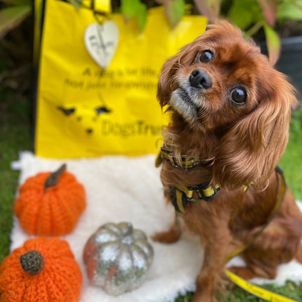
Manny

Winnie

Jet

Floki

Tilly

Rocco

Rocco

Bailey

Lottie & Shelby

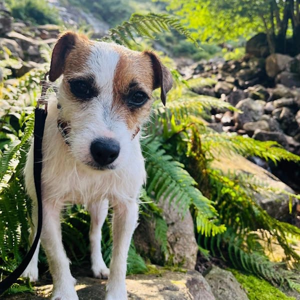
Sparky
Midge

Kibo